An Especial Ending Note
Although littered with science, this science section was written for universality amongst the RPSs of RPGs. Although written with RPGs in mind, it is still me best attempt at explaining it from a general populace PoV. My success depends on whether you grasp the concepts.
ESPECIAL NOTE: ALL images are displayed within page width using original size if width > 900px.
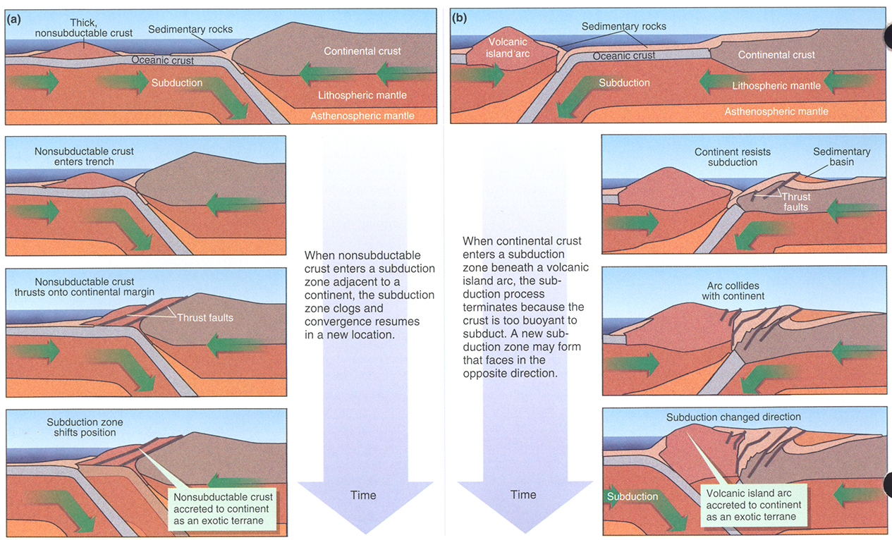
- AccretionExoticTerranes318.jpg | 1265px × 766px
- A visualization of how “exotic terranes” can accrete.
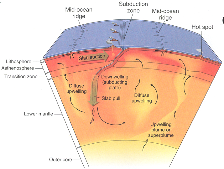
- ConvectionGlobalTectonics292.jpg | 715px × 540px
- Visualization of oceanic crustal convection.
- DivergentBoundary271.jpg | 775px × 591px
- Visualization of oceanic MOR at divergence zone.

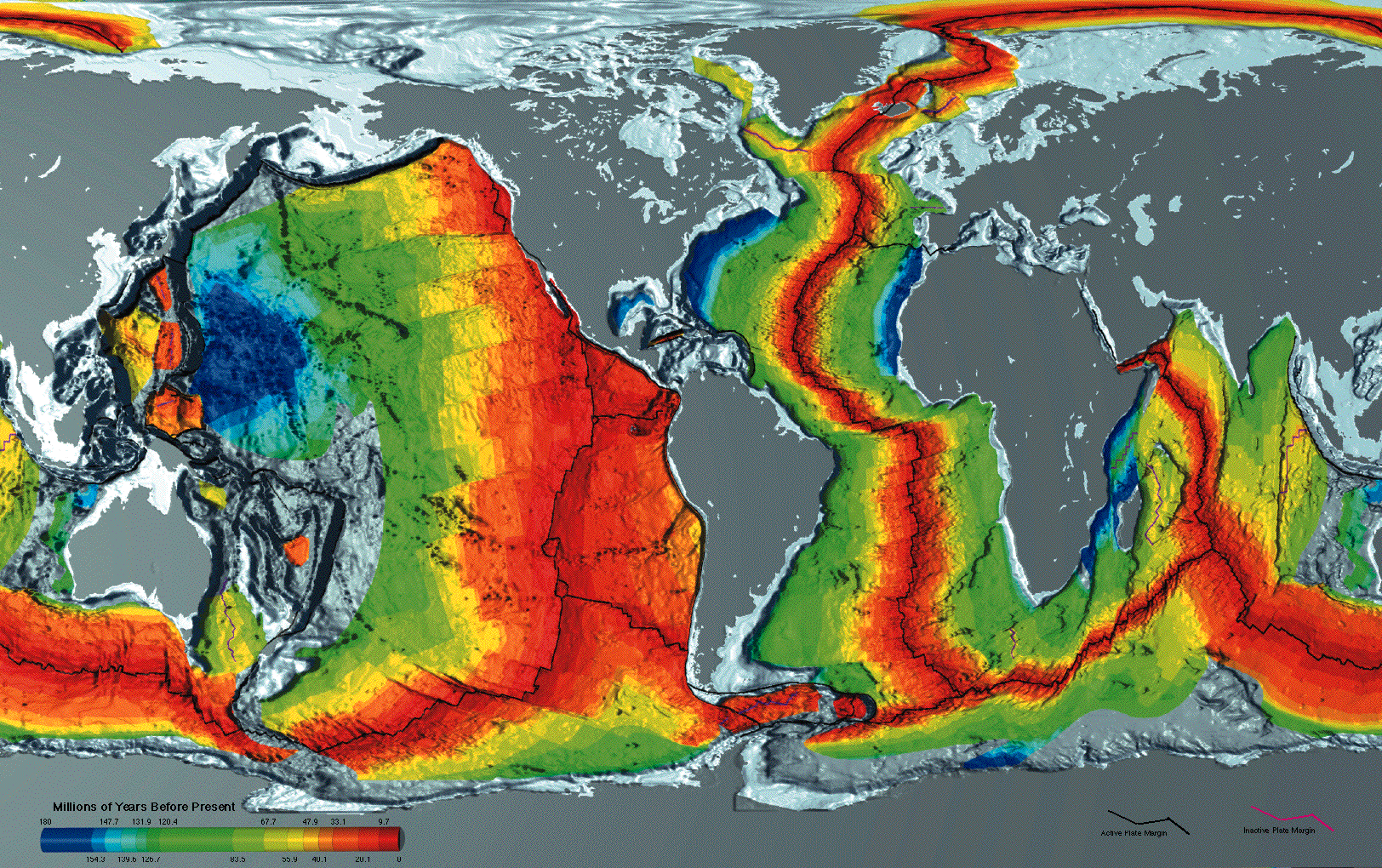
- EarthSeafloorCrustAge1996.gif | 1624px × 1020px
- Mapping of the age of the Oceanic Crust. Notice how none is older than about 250Ma.
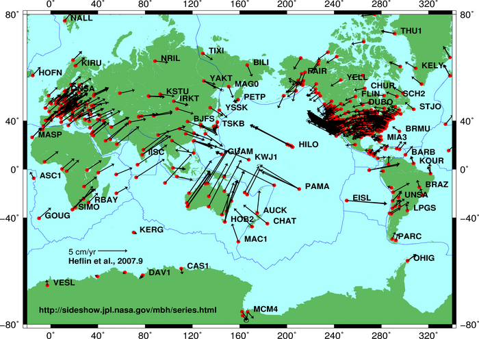
- GlobalPlateMotion2008-04-17.jpg | 700px × 495px
- Current motion of the tectonic plates.
- GneissNorthCarolina113.jpg | 656px × 528px
- Visited this site many times collecting samples. I have one piece of this gneiss about the size of my fist (≅7cmR). It weighs in at whopping 4341g (4.341kg; 9.57lbs). Smaller than a bowling ball, yet weighs almost as much. Need I mention DENSITY? Fact Check: Bowling Balls average 10.8cmR and mass 3-8kg. 3D model laser scanner showed that piece of gneiss is ≅1438cm3, giving this particular piece of gneiss a density of 3.02g/cm3. Bowling ball ≅5277cm3. In comparison, the gneiss is only 0.2725× the volume (27.25%), but masses between the 3-8kg mass of a bowling ball. Using the median of 5.5kg, density would be 1.04g/cm3. That gneiss averages 3× the density of a bowling ball.

- InsolationSummerSolstice65N.png | 1000px × 245px
- Measurements of Insolation received at 65°N latitude.

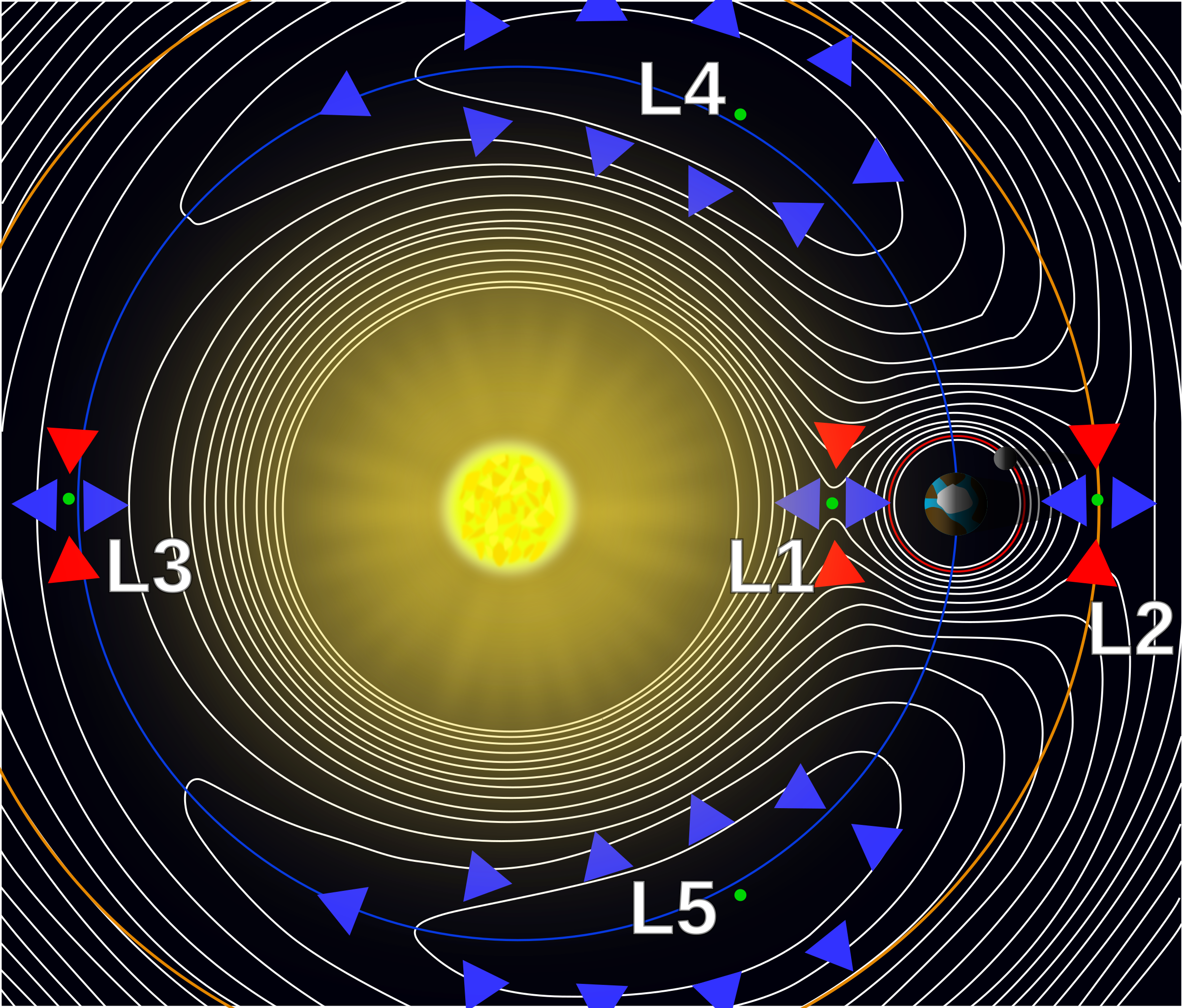
- Lagrange_points2.svg.png | 2403px × 2048px
- Visualizing the Lagrange Points and gravity.
- Lake_Thetis-Stromatolites-LaRuth.jpg | 800px × 584px
- Where the oldest forms of life were found from 3.8±0.1Ga.

- MapMajorFloodBasaltProvinces-Crpd.png | 832px × 469px
- Map of the Major Basalt Flood Provinces.

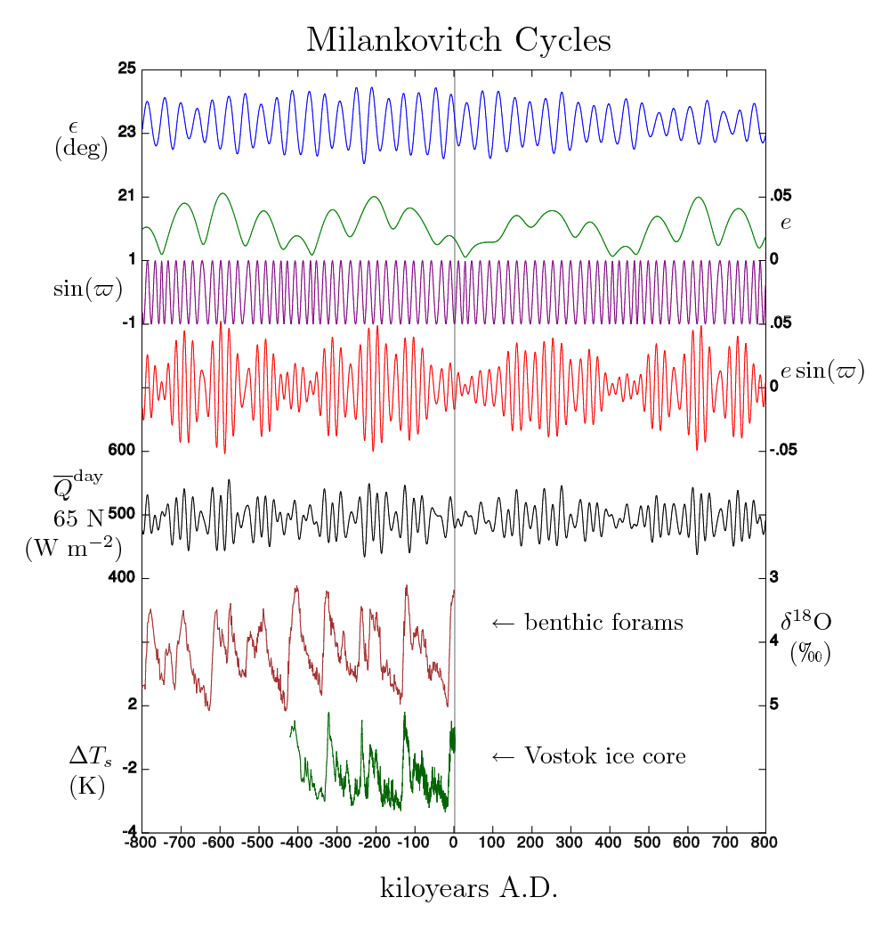
- MilankovitchCyclesOrbitandCores.png | 1000px × 1044px
- The Milankovitch Cycles. Even your fantasy world has them. Have fun with the calculations...
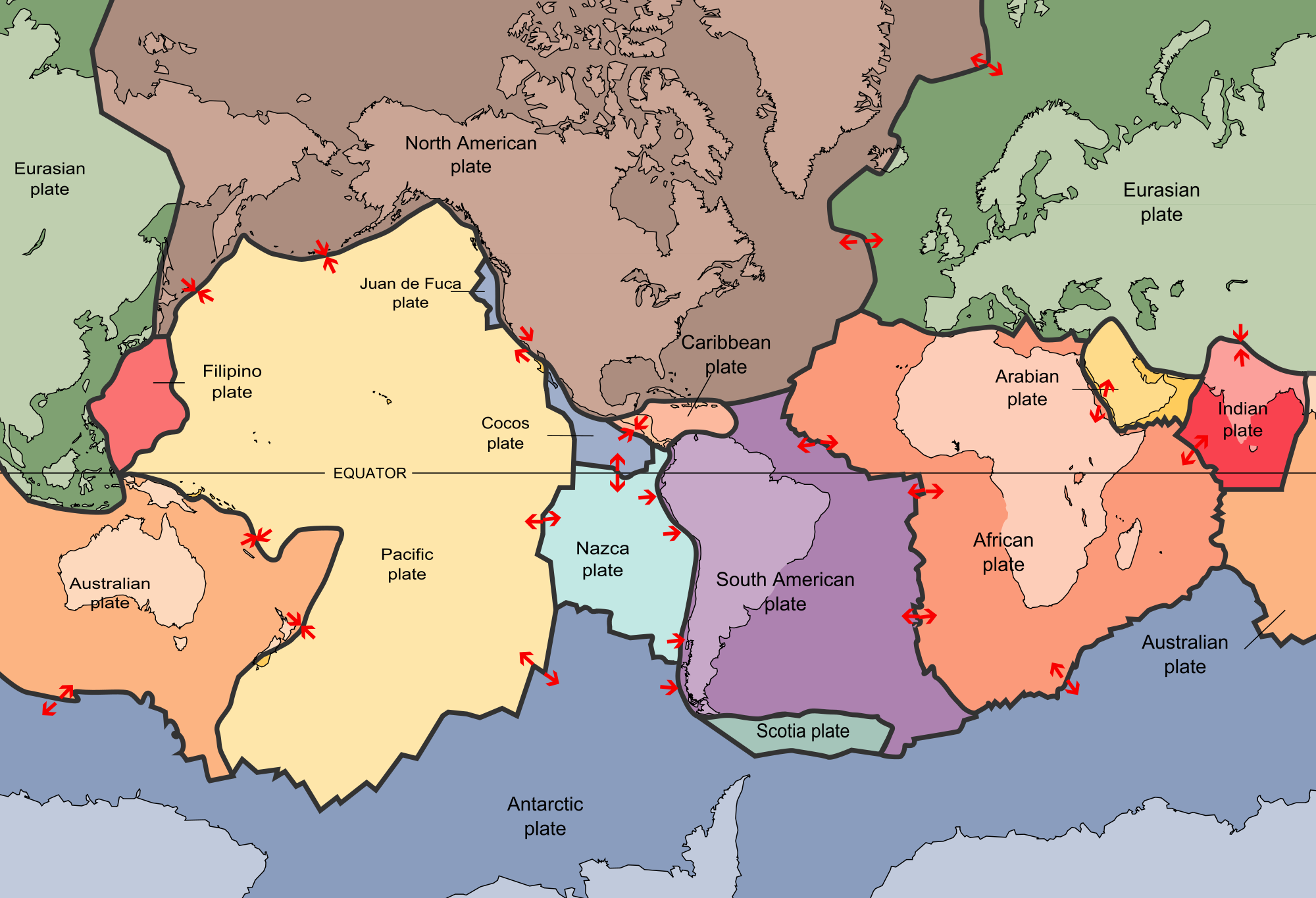
- PlatesTectonics.png | 2000px × 1365px
- Map of Global Major Tectonic Plates.
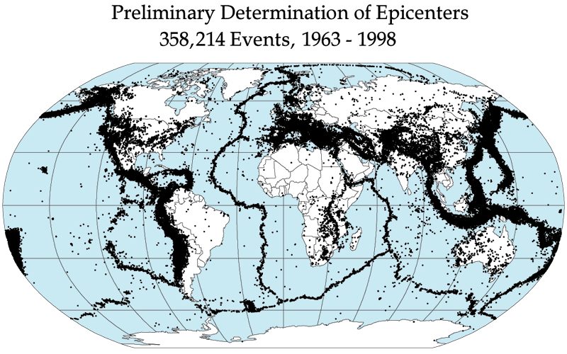
- QuakeEpicenters1963-1998.png | 800px × 500px
- Mapping 35 years of recorded quakes.
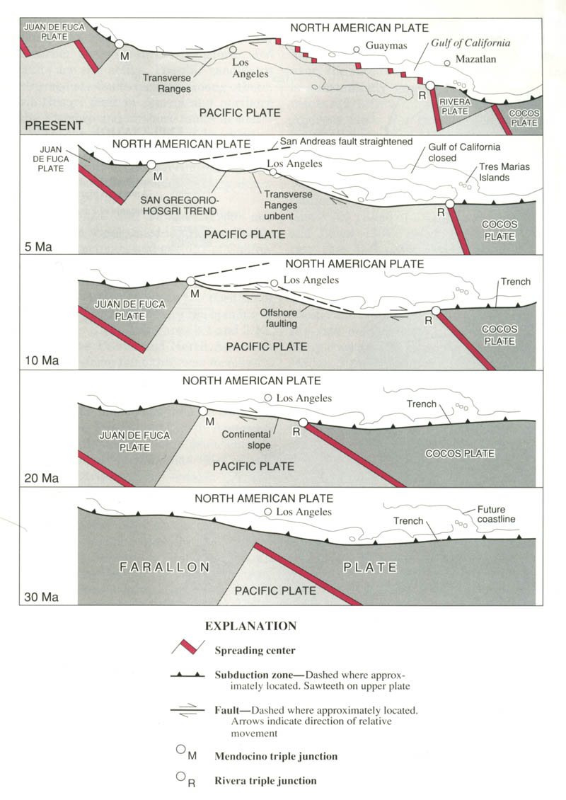
- SanAndreasFaultSequentialDiagrams.jpg | 800px × 1130px
- How the San Andreas Fault went from convergent to transform.
Another hilarious example of: “Follow Instructions”

My next super-ambitious project I am developing is a 1296 thousand pixel by 648 thousand pixel map of Etherlond. Basically, the scale would be: 1 pixel = 1 second of 1 minute of 1 degree. And that is what? 839,808,000,000 pixels. 839.8Gpx. And that is for the “null” layer only.
A globe will have 1,296,000 seconds in the DMS along the equator. Then 90° N & S would give a height of 648,000 seconds.
60″ × 60′ × 360° = 1,296,000″
For Etherlond, 1″ ≅ 6271.6mm, along the Equator ONLY. For Earth, 1″ ≅ 4915.9mm, along the Equator ONLY.
Ultimate Final Note
The somewhat easiest method is to just use the map of Earth as your world. Now place those “special locales”. I even did this once, using the greater georegion of my residence. The Appalachians were worse than the Rockies, having some volcanoes, and apexes always snow covered. Formidible geographic barrier. Disastrous lahars when an eruption occurs.
AND, using the Earth already gives you the climate zones and biomes. Of course, creating something like Tolkien did is also fun. Nevertheless, how scientifically feasible you make your RPC world is always the GMs Ultimate Decision.
— The Unknown Atheist
Copyright © 2024 by RMFR. Licensed under CC-BY-NC-SA 4.0 International. All Other Rights Reserved